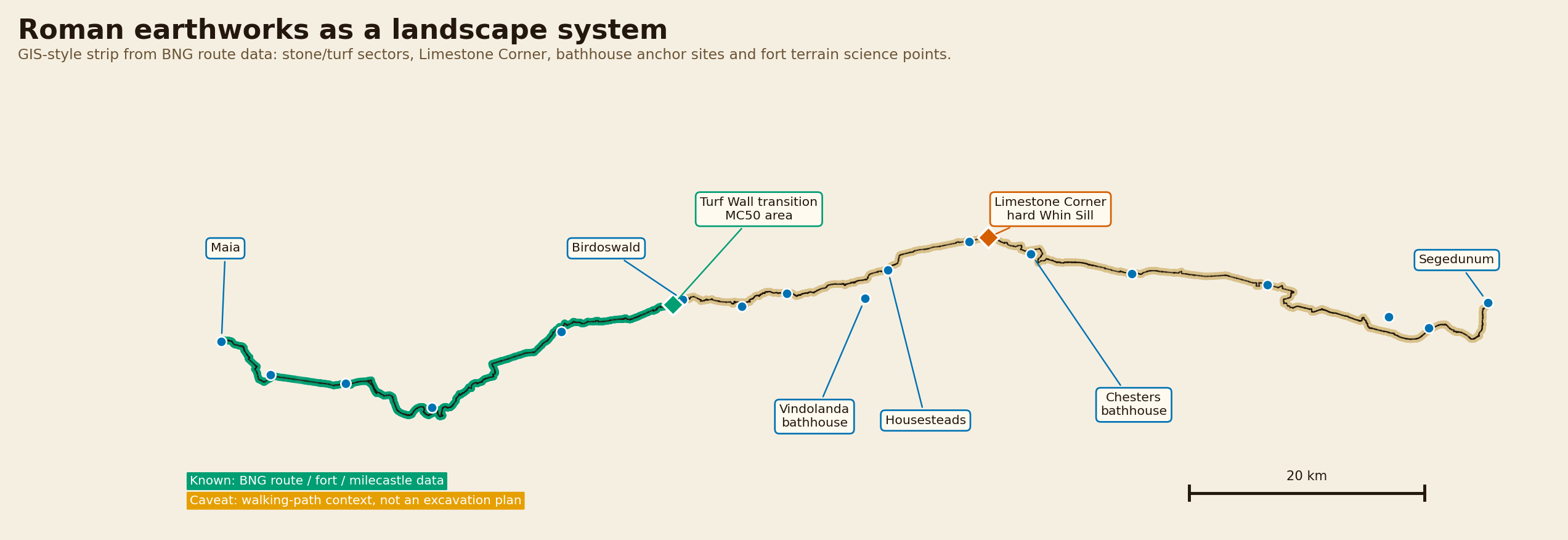
BNG route / fort / milecastle plotting
A Fort Science visual pack about how Roman soldiers cut ground, moved spoil, hit hard rock, built turf and earthworks, organised labour and washed the mud off. Built from a corrected evidence dataset with confidence labels on every major claim.
BNG route / fort / milecastle plotting
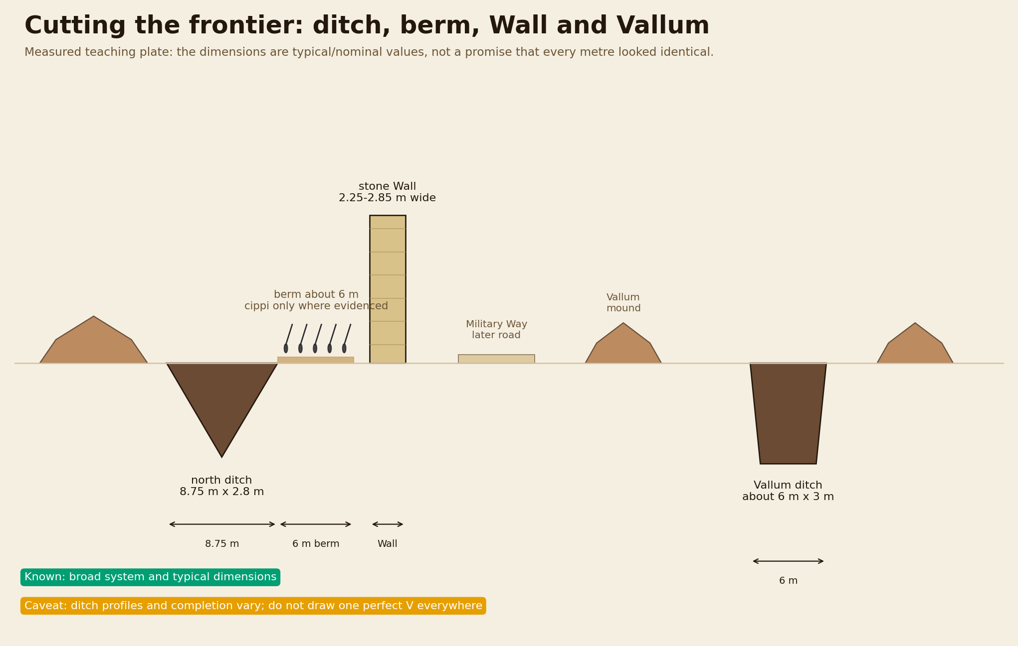
Measured schematic
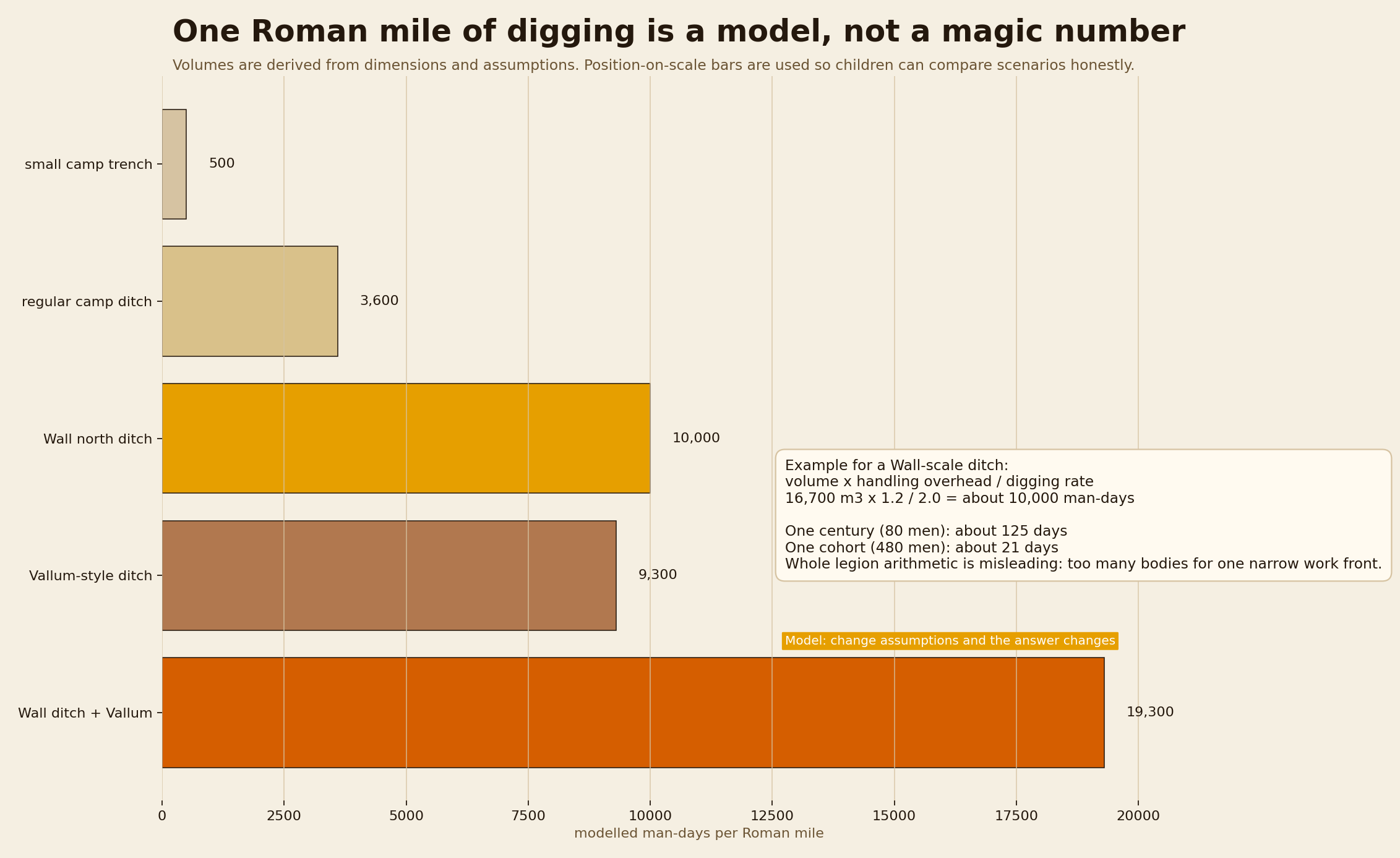
Volume and man-day model
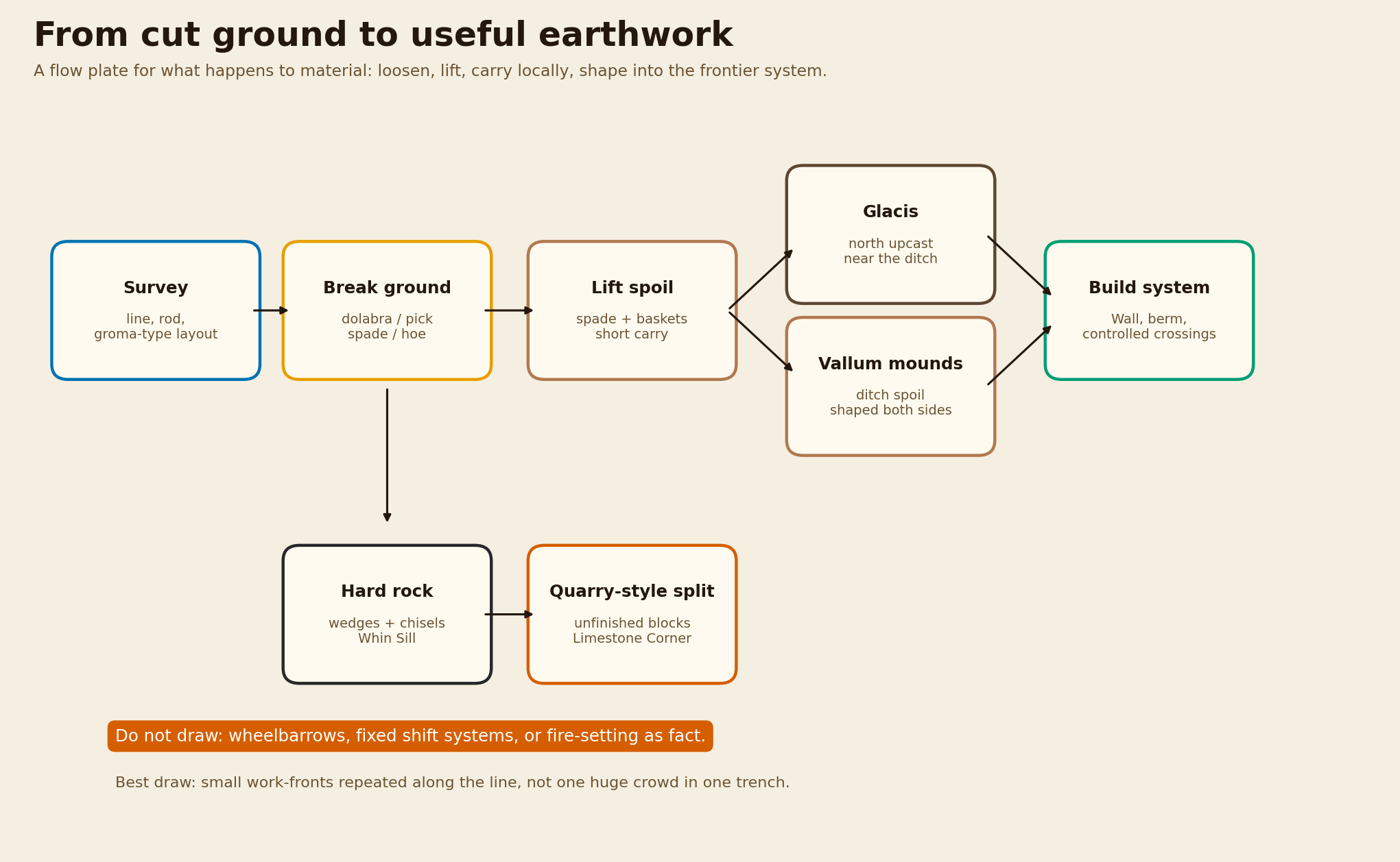
Evidence-labelled process flow
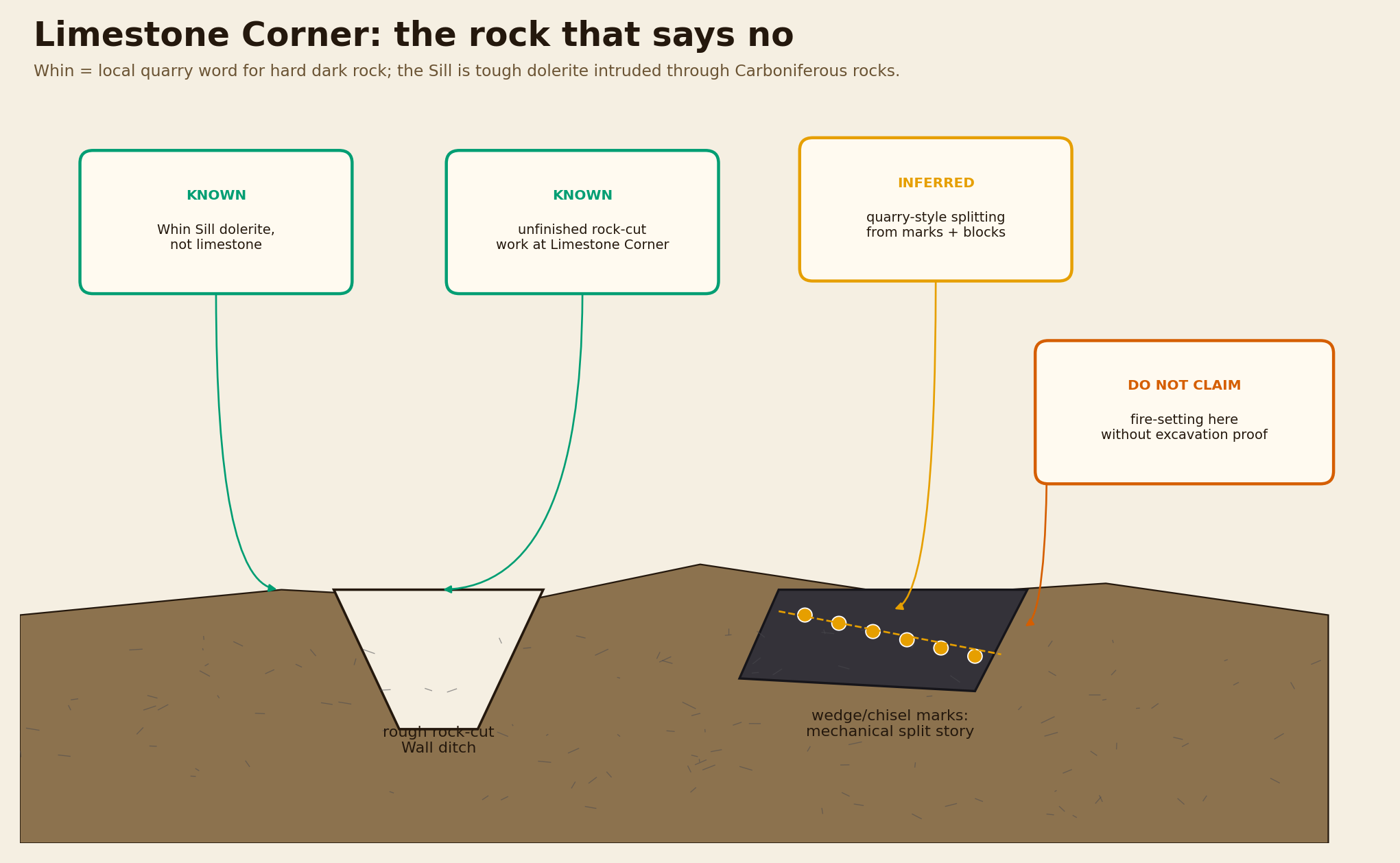
Geology / evidence plate
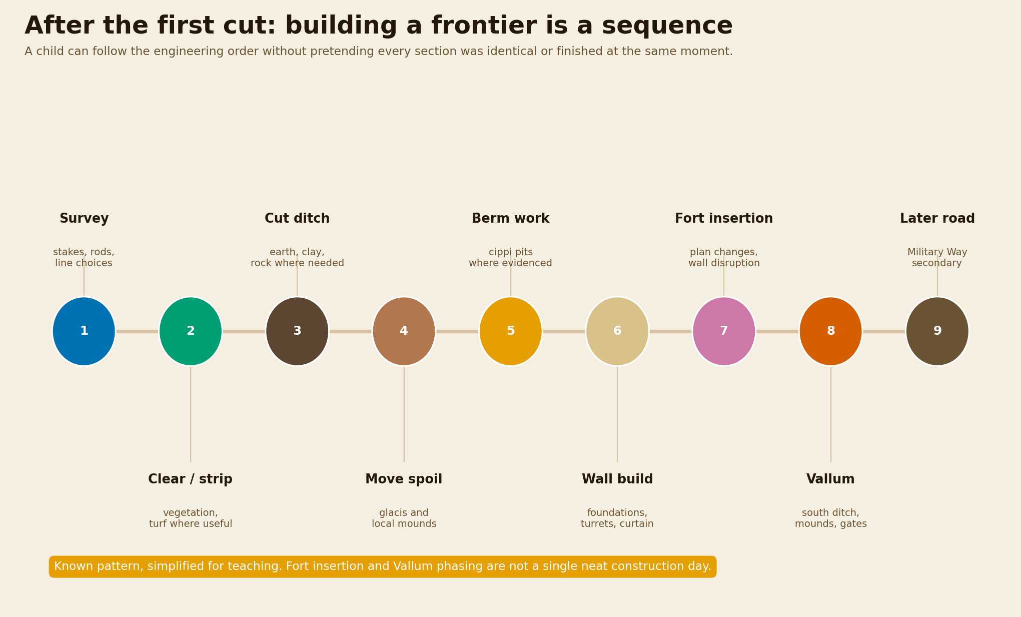
Phasing strip
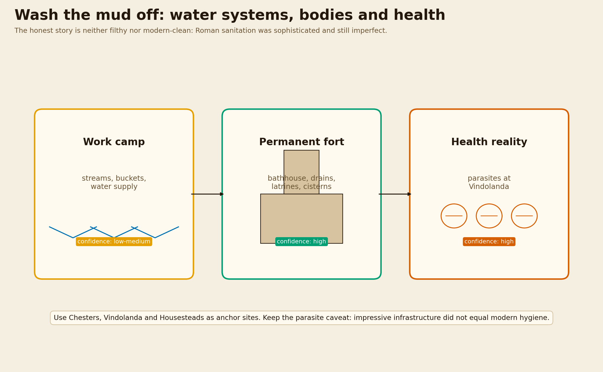
Systems comparison
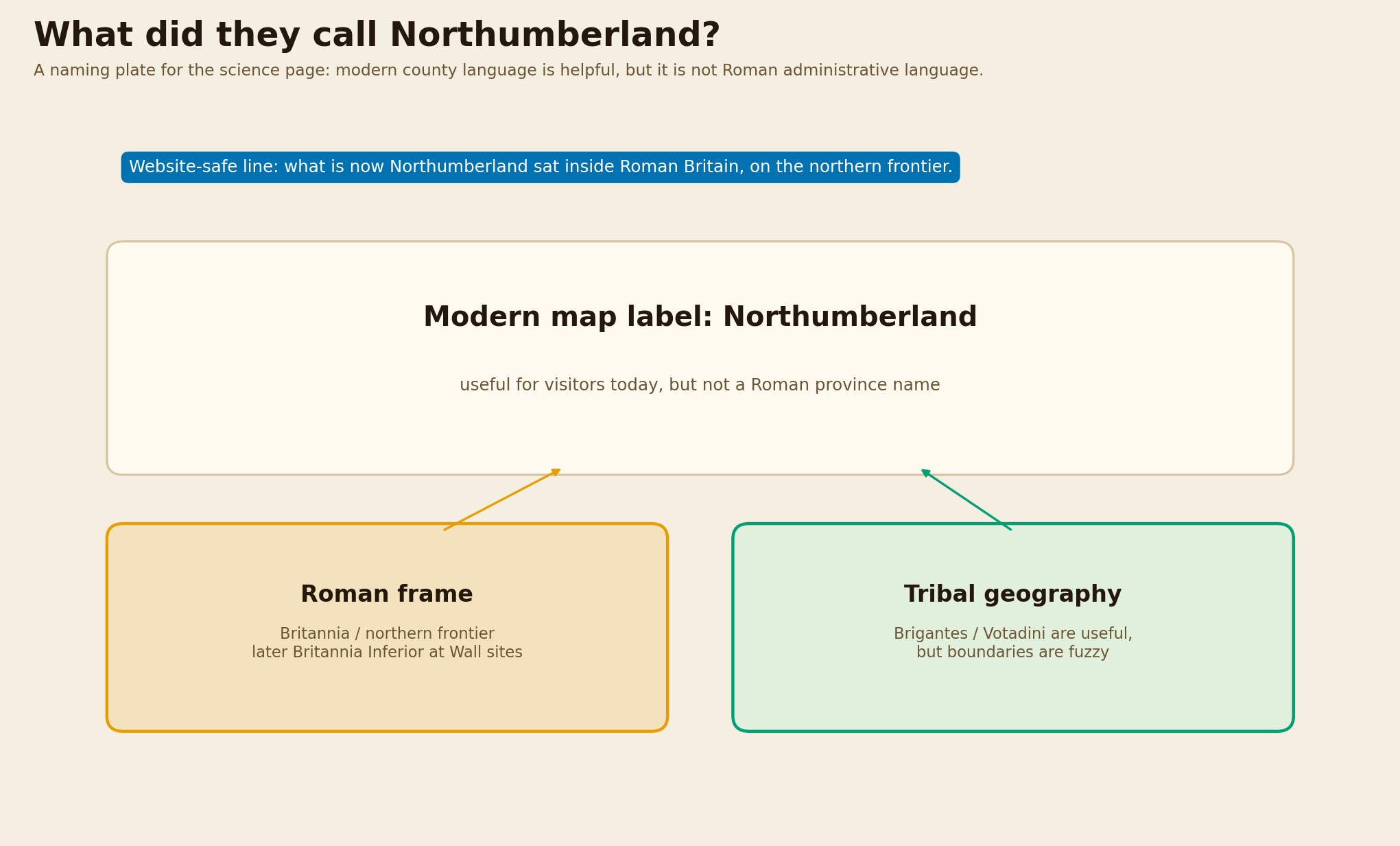
Naming / context plate
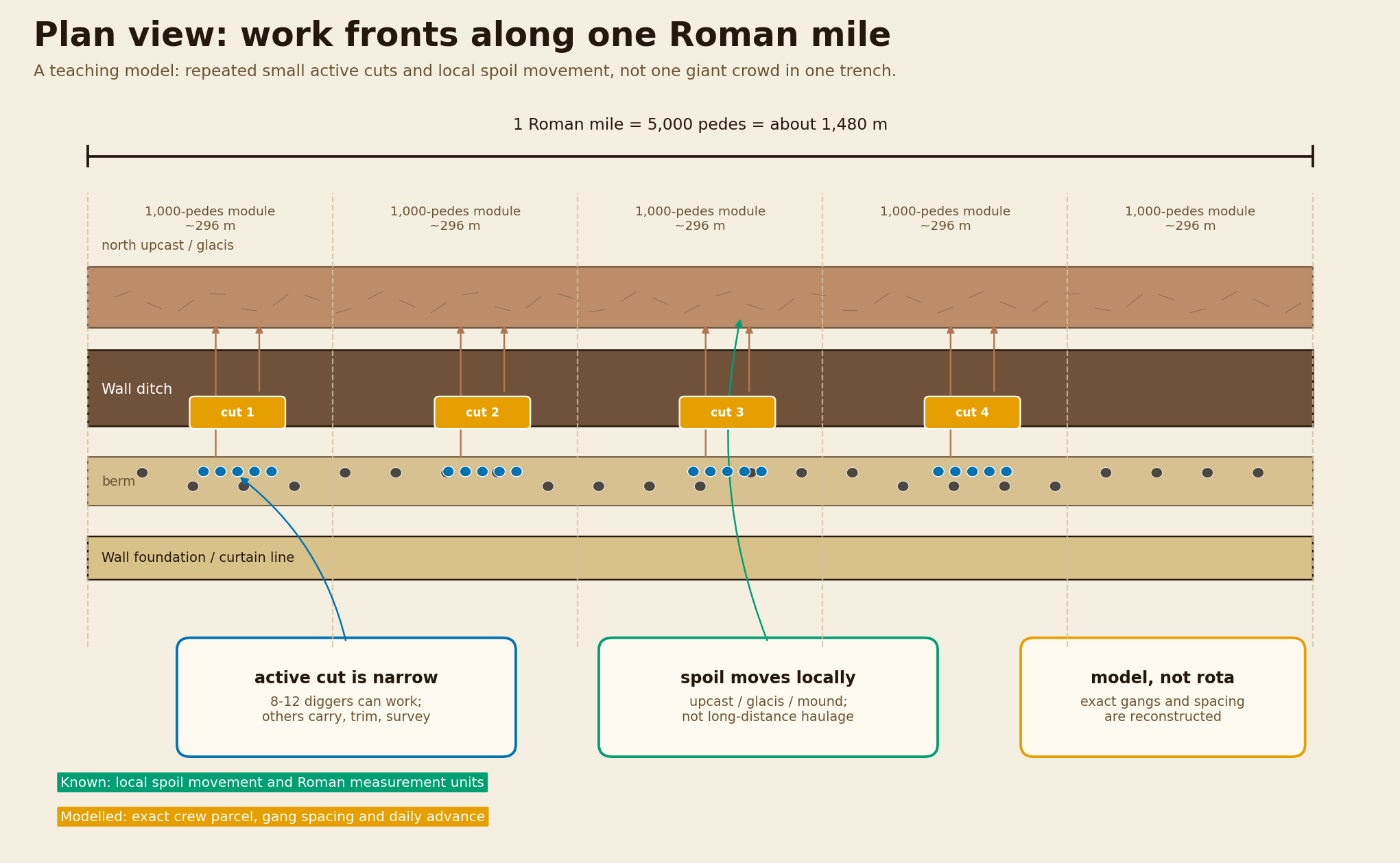
Plan-view labour model
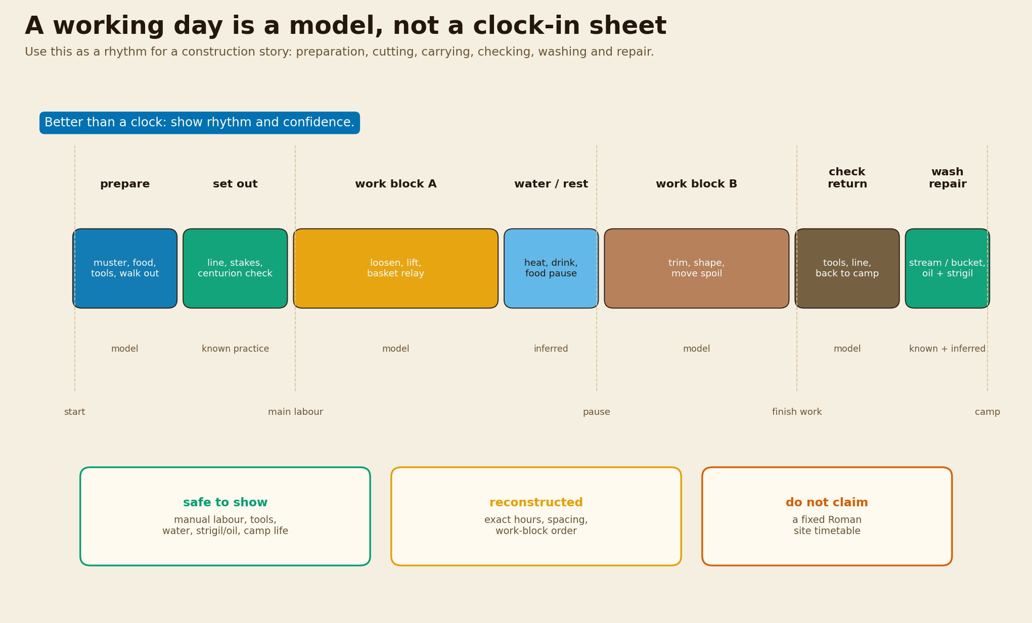
Confidence-labelled rhythm model
This page separates known evidence from reconstruction and modelled values. It uses GIS-style BNG plotting for the corridor strip, measured schematic cross-sections for earthworks, and position-on-scale charts for man-day comparisons.
Research status: developing educational synthesis. Keep confidence labels with any public reuse.